Botswana | Guyana | Ecuador | Malaysia | Suriname | Zimbabwe

Photos of aerial


Aerial view of rainforests in Sabah, Malaysia


Aerial view of palm oil plantation in Sabah, Malaysia


Settlement and deforestation along Napo River in Ecuadorian Amazon


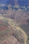
Aerial view of the Colorado River in Grand Canyon National Park, Arizona


Settlements and deforestation along Napo River in Ecuadorian Amazon


Aerial view of deforestation in Sabah, Malaysia


Settlement and fragmented forest along road in Ecuadorian Amazon


Industry in Sabah, Malaysia


Aerial view of deforestation in the Ecuadorian Amazon


Aerial view of the Colorado River in Grand Canyon National Park, Arizona


Aerial view of Quito, Ecuador


Mountains in Sabah, Malaysia


Frozen stream near Ely, Minnesota


Recently cleared forest near frontier town, Coca, in the Ecuadorian Amazon


Landscape of Okavango delta from above


Aerial view of palm oil plantations and forest in Sabah, Malaysia


Fenced in settlement in Okavango delta


Aquaculture in the Okavango delta?


Aerial view of South African giraffes (Giraffa camelopardalis giraffa) in the Okavango delta


Landscape of Okavango delta from above


Flower near Two Harbors, Minnesota


Aerial view of the Grand Canyon, Arizona


Industry in Sabah, Malaysia


Aerial view of the Colorado River in Grand Canyon National Park, Arizona


Landscape of Okavango delta from above


Aerial view of frontier town, Coca, in the Ecuadorian Amazon


Aerial view of South African giraffe (Giraffa camelopardalis giraffa) in the Okavango delta


Palm oil near frontier town, Coca, in the Ecuadorian Amazon


Lake Superior shoreline in Minnesota


Outskirts of frontier town, Coca, in the Ecuadorian Amazon


Fragmented forest in Ecuadorian Amazon


An aerial view of an island in the Caribbean.


Aerial view of deforestation in Sabah, Malaysia


Outskirts of frontier town, Coca, in the Ecuadorian Amazon


Aerial photo of plane's shadow in Grand Canyon National Park, Arizona


Landscape of Okavango delta from above


Aerial view of Napo River and Coca, a frontier town


Road and settlement cut through rainforest along the Napo River in the Ecuadorian Amazon


Outskirts of frontier town, Coca, in the Ecuadorian Amazon


Aerial view of Hippo (Hippopotamus amphibius) in the Okavango Delta


Aerial view of deforestation in Sabah, Malaysia


Edge of frontier town, Coca, in the Ecuadorian Amazon on the Napo River


Page 1 | Page 2


While these photos are the property of mongabay.com, it may be permissible to use them for non-commercial purposes (like powerpoint presentations and school projects), provided that the images are not altered in any form. Please read this for more details. If you are interested in using an image in a publication please contact mongabay


SHARE:


PERMISSION & USE
  • You may print this image for personal use.
  • You may share this image via social media.
  • Provided the mongabay.com logo is not removed, you may post this picture on your web site -- please include a link back to this page -- and use it for school projects and powerpoints.
  • If you are interested in using this photograph commercially and/or in a publication, please contact mongabay. Please reference the URL of this photo in your email. High resolution versions may be available and it may be possible to make this image available on a t-shirt or other products.


    Search for other pictures


  • what's new | rainforests | tropical fish | for kids | search | about | copyright & use | contact

    Copyright Rhett Butler 1994-2012

    Pictures were taken by Rhett A. Butler, copyright 1996-2009. While these photos are the property of mongabay.com, it may be permissible to use them for non-commercial purposes (like powerpoint presentations and school projects), provided that the images are not altered in any form. Please read this for more details. If you are interested in using an image in a publication please contact me.


    Mongabay.com is a free resource.