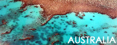
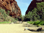
Pictures of Outback in Australia
All images are the property of Rhenda Glasco. Contact me with questions regarding use, reproduction, or purchase of any of the pictures.
Recommended travel guides on Australia:


Australia -- from Wikipedia
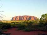
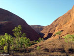
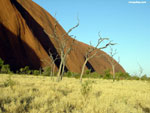
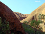
Uluru (also Ayers Rock or The Rock) is a large rock formation in central Australia, in the Northern Territory. It is located in Uluru-Kata Tjuta National Park, 350 km southwest of Alice Springs at 25� 20' 41? S 131� 01' 57? E. It is the second-largest monolith in the world (after Mount Augustus, also in Australia), more than 318 m (986 ft) high and 8 km (5 miles) around. It also extends 2.5 km (1.5 miles) into the ground. It was described by explorer Ernest Giles in 1872 as "the remarkable pebble".
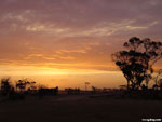
Uluru is notable for appearing to change colour as the different light strikes it at different times of the day and year, with sunset a particularly remarkable sight. The rock is made of sandstone infused with minerals like feldspar (Arkosic sandstone) that reflect the red light of sunrise and sunset, making it appear to glow. The rock gets its rust color from oxidation.
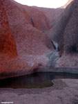
Uluru is sacred to the Aborigines and has many varied springs, waterholes, rock caves and ancient paintings. Ayers Rock was the name given to it by European settlers, after the Premier of South Australia Henry Ayers. Uluru is the name in a local Aboriginal language (Arrente), and since the 1980s has been the officially preferred name, although many people, especially non-Australians, still call it Ayers Rock.
The Aboriginal community of Mutitjulu (pop. approx. 150) is near the western end of Uluru. From Uluru it is about 21 km to the tourist town of Yulara (pop. 3,000), which is situated just outside of the National Park.
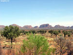
Kata Tjuta, which literally means 'Many Heads' owing to its peculiar formation, is another rock formation about 25 km from Uluru. They are called the Olgas by many Australians. Special viewing areas with road access and parking have been constructed to give tourists the best views of both sites at dawn and dusk.
On 26 October 1985, the Australian Government returned ownership of Uluru to the local Aboriginal people, the Anangu (or 'people'), of the Pitjantjatjara tribe, who then leased it back to the Government for 99 years as a National Park.
The local indigenous community request that visitors respect the sacred status of Uluru by not climbing the rock, with signs posted to this effect.
In 1983 the former Prime Minister of Australia, Bob Hawke, promised to respect the request from the community that climbing Uluru be prohibited, but broke his promise when title was handed to the traditional owners in 1985 because access for tourists to climb Uluru was made a condition before they could receive the title. The climb crosses an important dreaming track, which has been a cause of sadness and distress among traditional owners.
Neverthless, they are unable to prohibit climbing, and climbing Uluru is a popular attraction for a large fraction of the many tourists who visit it each year. A rope handhold makes the climb easier, but it is still quite a long and steep climb and many intended climbers give up partway. There are several deaths a year as a direct result of climbing the rock, mainly from heart failure.
[an error occurred while processing this directive]
|